

MEMPHIS, Tenn. (localmemphis.com) – Get ready for some of the coldest air we’ve seen this winter.
Skies will become cloudy Thursday night as our next cold front passes the Mid-South. A few flurries will be possible, but no significant precipitation. Temps in Memphis will be in the upper 30s around 7:00pm and the mid 30s around 10:00pm. Friday morning lows will be in the upper teens to low 20s with wind chills in the low teens.
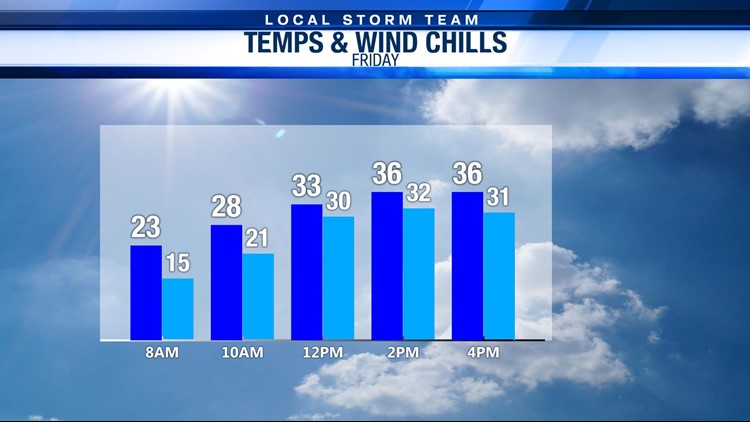
Friday will be sunny, but cold, as afternoon highs warm into the mid 30s. Feel like temps will be closer to 30 for the afternoon. Lows Friday night will fall into the upper 20s. A warm-up is expected to return for the weekend. Saturday will see a mix of sun & clouds and highs in the upper 40s. Isolated showers will be possible Sunday with highs around 50.
We will be keeping our eyes on our next big weathermaker early next week. Monday will start off sunny with a few showers possible later in the evening as highs warm into the upper 50s. A cold front moves through overnight Monday will lead to a rain & snow mix with snow possible by Tuesday morning. At this time, it is too early to tell how much snow we could see if the forecast holds. It will be cold, though, with Tuesday morning lows in the mid 20s and afternoon highs around 30.